
 |
 |
 |
 |
 |
 |
 |
 |

An added bonus to the already fascinating array of habitats located within the Murphy's Bottom property is the rich anthropogenic history that surrounds the site. Although the property is named after a Revolutionary War hero, its human history goes back even further. At least two official archeological digs have been performed on the property while amateurs still occasionaly search (and find) various pre/historic artifacts.
In an article from the Pennsylvania Archaeologist, Richard L George claims that, "there is much evidence that the entire Murphy's Bottom terrace was utilized for thousands of years." The formal excavations on the site, which focused on the prehistoric components, have unearthed everything from pots and arrowheads to complete sets of human remains. Interestingly enough these finds have been dated to various time periods indicating that, as Mr. George stated, the land was a hot-spot for use among Native Americans.
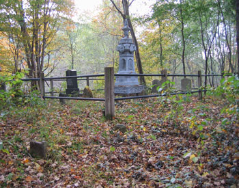 Despite the previous presence of these early inhabitants, the land was formally named after Samuel Murphy who took ownership of it in 1798 (through the Depreciation Land Act of 1783). Murphy became a farmer on the property and eventually passed it down to his descendents. As an interesting sidenote, the Murphy family cemetery is still located on a wooded part of the proptery and is surrounded by nondescript sandstones marking the graves of Native American servants (see picture insert). Eventually the land was split into multiple parcels and continued to be farmed by various citizens. Sometime during the mid-20th century the a large portion of both the property in question and surrounding plots was gathered under the Shawmut Development Company, a land-holding entity. During this time a variety of its sister companies began to harvest the resources of the land (namely coal and timber) and build railroads to transport the goods.
It wasn't until the early 1970's when sand and gravel mining/processing began on the portion of land to be reclaimed by this project. A company known as Davison Sand and Gravel leased the mineral rights and mined raw materials from the central protion of the property and transported it to a small processing plant set up on the eastern edge. It was this mining process that created the two principal lakes on the property (that were at one point connected directly to the Allegheny). They also cut a basin into the river bank to allow for barge docking/filling. Mining activities ceased during the late 80's and most of the structures/equipment involved in the endeavor were removed. In the mid-1990's a coal hopper and conveyer were installed to transfer coal from barges (in the aforementioned barge basin) but was only used for a short time. This equipment, owned by the railroad, still remains on the site to this day.
Through a series of corporate acquisitions the mineral rights now belong to Hanson Aggregates North America while the land proper belongs to Snyder Associated Companies. In 2006, access to the land and funds to reclaim the site were offered to Duquesne Univeristy by Hanson Aggregates, Synder Associated Companies, and the Pennsylvania Department of Environmental Protection. Hence the Murphy's Bottom Ecological Project was started.
Below are a few interesting historical links:
Aerial Photographs (inlcuding historical ones)
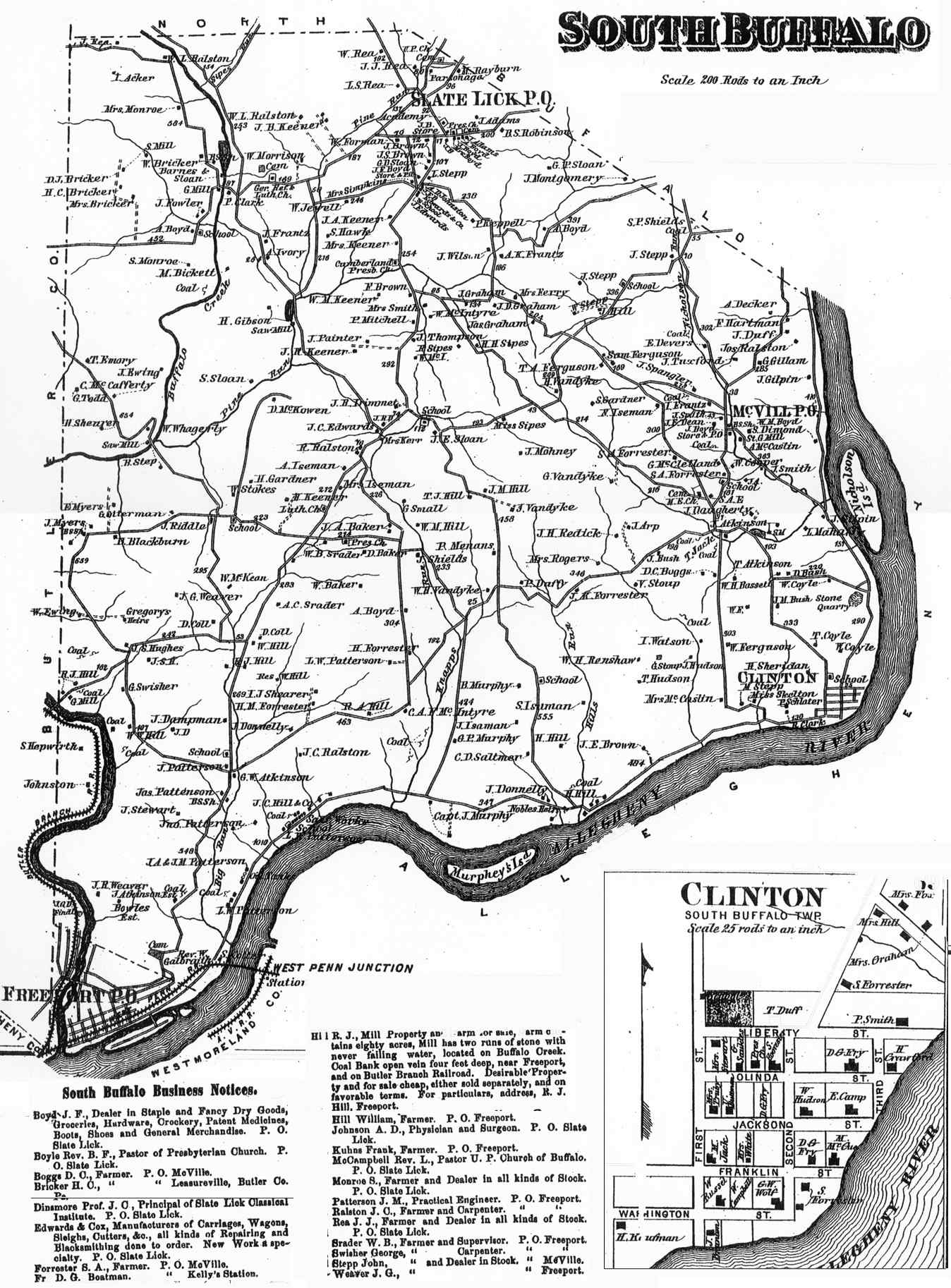
Historical Map of South Buffalow Township
Listing of Armstrong County cemeteries
Smith's History Project (In particular, check out the links on South Buffalow Township and Murphy)
A Post-Gazette article about a hermit who used to live off the land at the site.
A NY Times article about a 1990 petroleum spill in Knapp Run